



Stages, tracks, and places of the route
Experience every stage with mindfulness
On this page, you will find all the essential information for every leg of the Trail: technical specs, brief descriptions, practical pre-departure tips, points of interest, and useful contacts for further details. Think of this as your mini-guide to help you face the journey prepared, safe, and with a heart open to discovering the treasures of every stop.
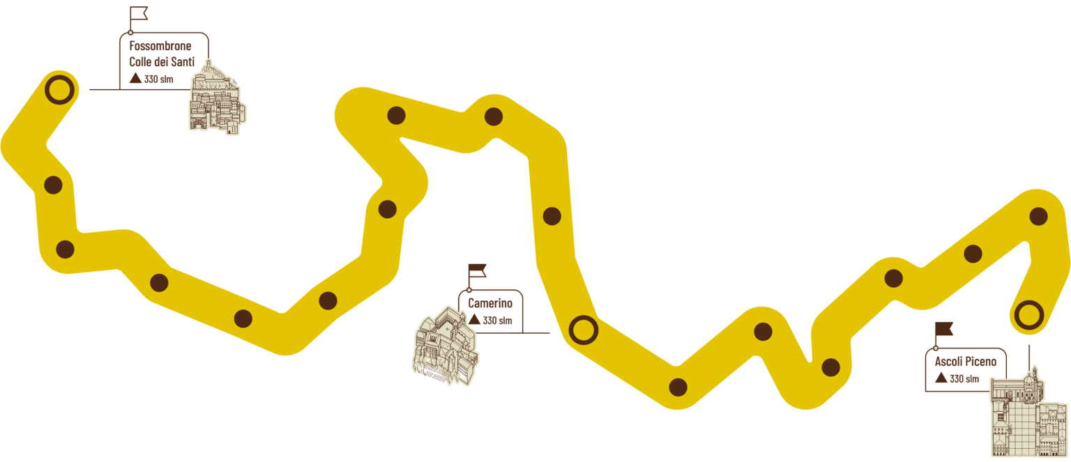

Fossombrone-Gola del Furlo
Powered by Wikiloc
Difficulty: medium-challenging
Length: 20.5 km
Ascent: 755 m
Descent: 894 m
Travel time: 6-7 h
Min altitude: 134 asl
Max altitude: 694 asl
Water sources: after 9 km at Sant’Anna
Surface: 74% dirt, 26% asphalt
Intermediate stages: low variant (14 km)
GPX track: download here
Brief description of the stage
The route starts from the Capuchin Friars’ Convent in Fossombrone. Along a mix of unpaved and paved roads, it crosses hills, vineyards, and countryside, offering wide views over the Metauro Valley and the mountains surrounding the Furlo Gorge. The track alternates flat, easy sections with more demanding ones, especially in the clay areas and on the paths in the second part of the route, when you climb Monte Pietralata.
As you approach the gorge, pilgrims can choose between two options: the easier route, which follows the river, passes through the Furlo Gorge, and reaches the destination in just 14 km; or the higher route, more challenging, which climbs Monte Pietralata and offers spectacular panoramic views from above of the gorge and the State Nature Reserve of the Furlo Gorge.
Both routes finally lead to the village of Furlo, the destination of the first stage.
What to know before departing
The Capuchin Convent of Fossombrone is located 3 km above the town and takes 45 minutes to reach on foot. The friars welcome pilgrims starting from 5:00 PM; there is no point in arriving earlier. Those staying overnight at the convent can, before reaching it, take the opportunity to visit the town of Fossombrone and its many attractions.
Pilgrims who stay overnight in town, instead, can go up to the convent the following morning and attend the 7:30 a.m. Mass. At the end of the service, the friars hand out the pilgrim credential and the Way’s pendant, and give pilgrims their blessing beneath the large cross.
Not to be missed
Upon arriving in Fossombrone, before heading up to the convent, it’s very pleasant to take a walk around town. Corso Garibaldi, the Church of San Filippo, the Ponte della Concordia, the Archaeological Museum, the Civic Art Gallery, the Cesarini House Museum (Quadreria Cesarini), and the Marmitte dei Giganti—located outside the town—are all treasures waiting to be discovered. Once you reach the Furlo Gorge, a visit to the beautiful Abbey of San Vincenzo al Furlo is a must.
Information
FOSSOMBRONE
IAT Point
Piazza Dante 23
Tel: 0721-72.32.63 / 340-82.45.162
Mail: puntoiat@comune.fossombrone.ps.it.
Website: visitfossombrone.it
GOLA DEL FURLO
IAT Point Furlo Reserve
Via Flaminia, Furlo
Tel: 0721-70.00.41 / 329-83.18.698
Mail: riservafurlo@provincia.ps.it.
Website: www.riservagoladelfurlo.it
MARCHE&BIKE
Via Furlo 9 – Parco La Golena, Furlo
For luggage transport and shuttle service in the first stages
Tel: 342-52.95.769
Mail: prenotazioni@marcheandbike.it
Website: www.marcheandbike.it
Difficulty: medium-challenging
Length: 21.4 km
Ascent: 838 m
Descent: 748 m
Travel time: 6-7 h
Min altitude: 178 asl
Max altitude: 605 asl
Water sources: 9 km (Agriturismo Ca’ Pierello; 13 km)
Surface: 93% dirt, 7% asphalt
Intermediate stages: farmhouses in Santa Maria delle Stelle area (10 km)
GPX track: download here
Brief description of the stage
The second stage runs parallel to the Candigliano and Burano valleys, alternating ascents and descents between Monte Varco, the Fosso Cherio valley, Monte Martello, and the plain of Cagli. The route crosses cultivated fields, pinewoods, and stretches of woodland, often opening up views of Mount Catria and Mount Acuto. Halfway along, the Sanctuary of Santa Maria delle Stelle invites you to stop, pray, and contemplate in one of the most evocative places in the area. The final descent leads toward Cagli, a city rich in history, where the ancient Capuchin Friars’ Convent stands on the hill: a simple, welcoming haven that keeps the pilgrim connected to the Franciscan origins of these lands.
Things to know before setting off
Along this stage, the only refreshment stop is the Ca’ Pierello agriturismo, 9 km after the start, where there is also a water spring and warm, family-style hospitality. You can contact them before setting off to have something prepared to eat, at +39 333 33 15 904.
Not to be missed
Halfway through the stage, on Monte Martello, the pilgrim comes across the Sanctuary of Santa Maria delle Stelle, a place that in the Middle Ages was frequented by travelers and pilgrims. To visit it, you need to contact Mrs. Mariella well in advance at +39 328 57 21 445.
Once you reach Cagli, it’s definitely worth stopping— and even staying overnight—at the Capuchin Friars’ Convent, a fine example of early Capuchin architecture. Also worth visiting are the 1289 Town Hall in the main square, the historic theatre—an authentic architectural gem—and the city’s beautiful ancient churches, such as San Domenico, Sant’Angelo Minore, San Bartolomeo, and San Giuseppe.
Information
SANTA MARIA DELLE STELLE
Loc. Monte Martello
For visits to the Sanctuary, call in advance at 328-57.21.445
CAGLI
IAT Point
Via Alessandri 4
Tel: 0721-78.07.73
Mail: iat.cagli@gmail.com
Website:www.visitcagli.it
Difficulty: challenging
Length: 20.9 km
Ascent: 951 m
Descent: 543 m
Travel time: 7-8 h
Min altitude: 249 asl
Max altitude: 833 asl
Water sources: after 7 km at Ca’ Ventura; 9 km at Paravento; 14 km at Frontone
Surface: 73% dirt, 27% asphalt
Intermediate stages: Frontone (after 14 km)
GPX track: download here
Brief description of the stage
The third stage is not particularly long, but it is still demanding due to the significant elevation gain. It passes through ancient hamlets, quiet woodlands, and wide panoramas toward the Castle of Frontone and the Catria massif. Frontone, reached after 14 km, is an excellent stop for those who wish to split the stage in two, or for a restorative break before tackling the second part of the route. The Way alternates gravel sections and forest paths, passing through places steeped in memory, such as Paravento with its historical events, and offers frequent water points and short, refreshing stops. As you climb toward Monte Roma, the landscape opens up, becoming increasingly contemplative. The final stretch, almost flat, leads at an easy pace to “La Forchetta,” from where the trail offers splendid views of the Monastery of Fonte Avellana, nestled among beechwoods and hazel groves. An arrival that invites silence, prayer, and rest.
Things to know before setting off
Sometimes, due to the monks’ commitments, it may not be possible to stay overnight at the Monastery of Fonte Avellana. In that case, there are two alternatives. The first is to spend the night in Frontone, which is 14 km after Cagli, and continue the next day to Pascelupo. The second is to stay at the Fronte del Parco hostel in Isola Fossara, located 8 km beyond the monastery, reachable at +39 331 77 57 046. The hostel also offers a shuttle service to pick pilgrims up from Fonte Avellana and take them back to the route the following day.
Not to be missed
In Frontone—especially for those who decide to stop there—you can visit the medieval hilltop village, with its distinctive alleyways, the evocative Castello della Porta (11th century), the Civic Tower, the Church of Santa Maria Assunta, and the Church of the Madonna del Soccorso.
Of particular importance is the Monastery of Fonte Avellana, an ancient Benedictine monastery dating back to the 10th century and mentioned by Dante. Inside, the Romanesque church, the crypt, and above all the famous Scriptorium—a masterpiece of architecture and light, and the spiritual heart of the complex—are especially worth seeing.
Informations
FRONTONE
Punto Iat
Piazza del Municipio 19
Tel: 380-13.77.626
Mail: puntoiat.frontone@gmail.com.
Website: www.montecatria.com
MONASTERO FONTE AVELLANA
Tel: 0721-73.02.61
Mail: info@fonteavellana.it
Foresteria: foresteria@fonteavellana.it
Website : fonteavellana.it
ISOLA FOSSARA
OSTELLO FRONTE DEL PARCO
Loc. San Benedetto
Tel: 331-77.57.046
Shuttle service available
Difficulty: medium
Length: 13.4 km
Ascent: 607 m
Descent: 759 m
Travel time: 5-6 h
Min altitude: 417 asl
Max altitude: 871 asl
Water sources: after 5 km at Pian delle Quaglie, 8 km at Isola Fossara, 12 km before Coldipeccio
Surface: 87% dirt, 13% asphalt
Intermediate stages: Isola Fossara (after 8 km)
GPX track: download here
Brief description of the stage
This stage leaves the silence of Fonte Avellana and immediately heads into the woods, with ups and downs, panoramic clearings, and wild stretches beneath the cliffs of Mount Catria. The route partly follows the “Sentiero Italia,” crossing beech forests and open pastures and offering broad views over the valley and the small mountain villages. The descent toward Piano Sant’Angelo and the meadows of Pian delle Quaglie, in the Monte Cucco Regional Park, gradually introduces a wider, brighter landscape, until reaching Isola Fossara, where you can stop for refreshments and stay overnight. The final section climbs gently toward Coldipeccio and then descends to Pascelupo, an ancient village nestled among gorges and woods—the gateway to a rugged, contemplative area rich in eremitic memories.
Things to know before setting off
This is the shortest stage of the Way (13.4 km) and can be tackled at a relaxed pace. In the morning, it’s worth taking some time to visit the Monastery of Fonte Avellana and its many treasures. Once you set off, when you reach the upper section beneath the eastern ridge of Mount Catria (960 m), you can stop and leisurely admire one of the most beautiful panoramas of the entire route. In bad weather, however, it is wise to avoid climbing the mountain and instead take the SP Avellana and then the SP to Isola Fossara.
Not to be missed
In Isola Fossara, 8 km beyond Fonte Avellana, it’s worth stopping at the Fronte del Parco Hostel for a memorable refreshment break and an immersion in the area’s history—or even to stay overnight. If you continue on and reach Pascelupo early, you can extend the route slightly to visit the evocative Rio Freddo Gorge, located 1.5 km further on. It is not recommended, however, to climb up to the Hermitage of San Girolamo, home to the Camaldolese Hermits of Monte Corona, which is currently not open to visitors.
Informations
ISOLA FOSSARA
Fronte del Parco Hostel
Loc. San Benedetto
Tel: 331-77.57.046
Shuttle service available
PASCELUPO
Website : turismo.comune.scheggiaepascelupo.pg.it
Difficulty: challenging
Length: 25.8 km
Ascent: 715 m
Descent: 927 m
Travel time: 8-9 h
Min altitude: 310 asl
Max altitude: 684 asl
Water sources: after 6 km at Piaggiasecca, 9 km at Viacce, 21 km at Marischio
Surface: 70% dirt, 30% asphalt
Intermediate stages: none
GPX track: download here
Brief description of the stage
The first part of the stage runs along the eastern ridge of Monte Cucco, through shady woods and paths that follow the Rio Freddo stream, climbing up to the panoramic viewpoint from which you can glimpse the Hermitage of San Girolamo. Along the way you discover small wonders such as the Sturo della Piscia waterfall and rural hamlets like Piaggiasecca, which accompany you toward the Abbey of San Cassiano at the 15th km—an ideal midway stopping point. From here the route continues gently along dirt roads and farm tracks, crosses the Marischio area, and reaches the outskirts of Fabriano. A final stretch along the city streets leads into the heart of the historic center, where pilgrims will find services, hospitality, and the living pulse of history.
Things to know before setting off
In rainy periods, before setting out, it’s a good idea to check the conditions of the ford immediately below Pascelupo. If it is not passable, it is recommended to follow the alternative route toward the hamlet of San Felice, indicated in the Walk+ app.
The stage is long, with numerous water sources, but it has no refreshment points or intermediate rest stops. It is therefore necessary to stock up on food at the start, unless you contact the Bar Alimentari Scotini in advance at +39 0732 73 299—located halfway along the route—and arrange to have lunch brought to the hamlet of Vallina, 13 km further on.
Not to be missed
After 5 km from the start of the route, you come to the spectacular Sturo della Piscia waterfall, a drop of over 15 meters that creates evocative plays of light and color. In Piaggiasecca, a small “open-air museum” of rural civilization awaits the pilgrim, with alleyways enlivened by ancient work tools. At the 15th km, the Benedictine Abbey of San Cassiano, founded between the 11th and 13th centuries, impresses with its sober stone elegance, its simple façade, and its distinctive, intimate crypt.
In Fabriano, the medieval historic center preserves squares, palaces, and art treasures such as the Sturinalto Fountain, the Cathedral of San Venanzio, the Civic Art Gallery, and the Oratory of Charity.
Informations
FABRIANO
Punto Iat
Piazza del Comune 38
Tel: 0732-70.94.24
Mail: iat.fabriano@regione.marche.it
Website: visitfabriano.it
GOLA DELLA ROSSA AND FRASASSI NATURAL PARK
www.parcogolarossa.it
Difficulty: very challenging
Length: 24.2 km
Ascent: 1148 m
Descent: 532 m
Travel time: 8-9 h
Min altitude: 236 asl
Max altitude: 1007 asl
Water sources: after 7 km, 10 km at Cerreto d’Esi, 14 km at Albacina, 17 km at Acquarella
Surface: 71% dirt, 29% asphalt
Intermediate stops: Cerreto d’Esi (after 10 km) and Albacina (after 12 km)
GPX track: download here
Brief description of the stage
This is one of the most demanding stages of the Way, both for its length and for the elevation gain, which is concentrated in the second part of the route. From the gentle landscapes around Fabriano, the path crosses countryside and gravel roads to Cerreto d’Esi and Albacina, where you can break up the walk and visit the villages. From here begins the toughest climb of the Cammino dei Cappuccini, leading through the silence of the woods toward the heart of the mountain. Along shaded paths and ever-wider panoramas, you come to the Hermitage of Santa Maria dell’Acquarella, a place for reflection and rest, before the final stretch which—with patience and a steady pace—brings you up to the high meadows and finally to Poggio San Romualdo.
Da sapere prima di partire
Poiché le tappe 4, 5 e 6 sono particolarmente impegnative, in questa tappa il pellegrino può valutare di fermarsi in uno dei punti intermedi, Cerreto d’Esi (10 km) o Albacina (12 km), in modo da poter recuperare energie e avere più tempo al mattino per visitare con calma la città di Fabriano e assaporare l’atmosfera di queste graziose cittadine. Oppure, in alternativa, da Fabriano può arrivare in treno a Cerreto d’Esi e partire direttamente da lì.
In Poggio San Romualdo, it is important to secure overnight accommodation in advance at one of the available facilities.
Not to be missed
Cerreto d’Esi preserves an imposing medieval castle with its leaning cylindrical tower and the Torrione dell’Agostino, overlooking historic alleyways and churches rich in works of art, such as the Collegiate Church of Santa Maria della Piazza with the crucifix by Brother Paolo da Chioggia.
Albacina, an ancient Roman and medieval settlement, offers remains of the castle and churches such as San Venanzo and Santa Maria della Piazza, guardians of sacred artworks and local devotions.
The Hermitage of Santa Maria dell’Acquarella, in the heart of the woods, is linked to the story of the Capuchins’ origins, while Poggio San Romualdo, on the summit of the mountain of the same name, preserves the ruins of the castle and commemorates Saint Romuald, founder of the Abbey of San Salvatore—a destination of peace and sweeping views, especially appreciated by summer visitors.
Informations
CERRETO D’ESI
Iat Points
Piazza Lippera 4
Tel: 0732-67.90.00
Website: www.visitcerretodesi.it
GOLA DELLA ROSSA AND FRASASSI NATURAL PARK
www.parcogolarossa.it
Difficulty: very challenging
Length: 24.9 km
Ascent: 787 m
Descent: 1218 m
Travel time: 8-9 h
Min altitude: 171 asl
Max altitude: 936 asl
Water sources: after 13 km at Sant’Urbano Abbey, 16 km at Castellaro, 21 km at the Hermitage of the White Friars
Surface: 71% dirt, 29% asphalt
Intermediate stops: Agriturismo Vallonga, tel. +39 339 22 39 818 (after 9 km); Casa Rossi, tel. +39 348 15 59 254, available to pick you up at Sant’Urbano Abbey (13 km).
GPX track: download here
Brief description of the stage
A long and demanding stage, and among the most meaningful on the Way. From Poggio San Romualdo you descend toward the Abbey of Valdicastro, a place linked to Saint Romuald and set in quiet, unspoiled nature. The route continues through woods, mule tracks, and open panoramas to the splendid Romanesque Abbey of Sant’Urbano, an ideal stop for a break. The final part leads through fields and hills toward Cupramontana, passing the ancient hermitages of the White Friars and the Black Friars—signs of a simple, secluded spirituality. It is a stage that requires energy and attention, but rewards you with history, beauty, and opportunities for reflection throughout the walk.
Things to know before setting off
There are no refreshment stops along this stage, so you need to stock up on enough food before leaving. If it is open at your departure time, you can do so at the small snack bar behind Valdicastro Abbey. On the abbey grounds, be careful because signage can be scarce, especially near the small lake. In this section it is important to follow the guide carefully and, if possible, rely on the GPX tracks or the Walk+ app.
Not to be missed
This is the stage richest in hermitages and abbeys along the entire route. Shortly after setting off, you come to Valdicastro Abbey, a fascinating spiritual and historic center linked to Saint Romuald, who lived here for a long time and died in 1027. At the 13th km, Sant’Urbano Abbey is an excellent stopping place, with water and restrooms, where you can eat and visit the splendid Romanesque abbey (10th–11th century), which is always open.
Toward the end of the route, in the middle of the woods, you discover the Hermitage of the White Friars, an ancient 11th-century complex carved into the rock, inhabited first by monks, then by friars, and later by Camaldolese monks; here, too, events crucial to the birth of the Capuchin Order took shape. Shortly after, the Hermitage of the Black Friars tells the story of the Franciscan Observants and houses the body of Blessed Giovanni Righi, a witness to eremitic life and penance.
Informazioni
ABBAZIA VALDICASTRO
Loc. Valdicastro, 31
Tel: 328-15.10.039
Sito: valdicastro.it
ABBAZIA SANT’URBANO
Contrada Sant’Urbano 3, Apiro
Website: vallesanclemente.it
CUPRAMONTANA
Punto Iat
Via Leopardi 1
Tel: 0731-78.01.99
Sito: www.turismocupramontana.com
Difficulty: medium
Length: 21.7 km
Ascent: 694 m
Descent: 567 m
Travel time: 6-7 h
Min altitude: 287 asl
Max altitude: 631 asl
Water sources: after 9 km at Apiro
Surface: 63% dirt, 37% asphalt
Intermediate stops: Apiro (after 9 km), accommodation facilities at Lake Cingoli (after 12 km)
GPX track: download here
Brief description of the stage
A stage of moderate difficulty, with a few climbs in the second part to be tackled at a relaxed pace. The route crosses open, panoramic landscapes, through fields and neatly rolling hills, with two possible stopping points: Apiro, where you can resupply, eat, or stay overnight; or, shortly after, Lake Cingoli, ideal for a refreshing break immersed in nature. From here, the route continues along gravel roads and woodland paths to Cingoli, the “Balcony of the Marche,” offering views that stretch from the sea to the surrounding hills and mountains. A varied and pleasant stage, alternating nature, villages, and wide panoramas, inviting you to slow down and enjoy the journey.
Things to know before setting off
It’s worth allowing a little extra time to visit Apiro and enjoy a restorative stop at Lake Cingoli. Since Cingoli is a tourist destination—especially during the busiest periods—it is advisable to book accommodation in advance.
Not to be missed
Along the stage you will come across places of great historical and natural interest. Just outside Cupramontana, the Abbey of the Blessed Angelo, founded by the Camaldolese, preserves the body of the martyred monk Angelo da Massaccio and a charming cloister. In Apiro, the Collegiate Church of Sant’Urbano with its 18th-century organ, the Town Hall with a triptych by Allegretto Nuzzi, and the Teatro Mestica—home to the Terranostra international folklore festival—are all well worth a visit.In Cingoli, don’t miss the Cathedral of Santa Maria Assunta, the Church of San Esuperanzio, and the Church of San Filippo.
Informations
APIRO
Pro loco
Piazza Baldini 11
Tel.: 333-12.15.710
Mail: proloco.apiro@libero.it
Sito:turismo.comune.apiro.mc.it – www.festivalterranostra.it
CINGOLI
Punto Iat
Via Ferri 17
Tel: 733-60.24.44
Mail: iat.cingoli@regione.marche.it
Difficulty: challenging
Length: 28.4 km
Ascent: 820 m
Descent: 1221 m
Travel time: 8-9 h
Min altitude: 226 asl
Max altitude: 731 asl
Water sources: after 13 km at San Lorenzo di Treia, 24 km at Cesolo, after 27 km at Glorioso
Surface: 61% dirt, 39% asphalt
Intermediate stops: San Lorenzo di Treia (13 km), accommodation facilities on the Cherry Hill (20 km)
GPX track: download here
Brief description of the stage
The ninth stage, the longest of the Way, calls for a steady pace and a few planned breaks, but it rewards you with open landscapes and sweeping views. Along a mix of gravel roads and woodland stretches, the route alternates ascents and descents up to the Cristo delle Marche, a scenic viewpoint from which your gaze takes in the Adriatic and the inland hills. From here you descend toward the Hermitage of Sant’Angelo, linked to the early days of the Capuchin Order. The route continues along the slopes of Monte Acuto to San Lorenzo di Treia, an excellent midway stopping point. It then continues through a stretch of woodland leading to the evocative Cherry Hill, which offers wide views toward the Sibillini Mountains; and, among sanctuaries and small hamlets, the Way gradually brings you to San Severino Marche.
Things to know before you go
Given the length of this stage, you may find it helpful to divide it into two. You can stop after 13 km in San Lorenzo di Treia or after 19 km at the farmhouses of “Collina dei Ciliegi,” where you can enjoy a gentle, wide panorama toward the Sibillini Mountains. If you choose to stay in the convents or monasteries of San Severino, please note that once you reach Piazza del Popolo, it is about an extra 1 km uphill, as they are all located in the ancient upper part of the city. Taking an intermediate stop in San Lorenzo di Treia also allows more time to visit Cingoli before departing, arriving the following day in San Severino Marche with ease to enjoy its rich history and artworks.
Not to be missed
The southern slope of Monte Sant’Angelo preserves a very ancient cave dedicated to Saint Michael the Archangel, beside which the hermitage of the same name was later built. Here, between 1525 and 1526, the first Capuchins began an experience of reformed life that later led to the birth of the Capuchin Order.
Information
TREIA
Pro Loco
Tel: 0733-21.87.78
Email: prolocotreia.iat@comune.treia.mc.it
Website: www.comune.treia.mc.it
SAN SEVERINO MARCHE
Pro Loco
Piazza del Popolo 43
Tel: 0733-63.84.14
Email: proloco.ssm@gmail.com
Website: turismosanseverinomarche.it
Difficulty: easy to moderate
Length: 16.3 km
Ascent: 685 m
Descent: 299 m
Travel time: 5-6 h
Min altitude: 229 asl
Max altitude: 775 asl
Water sources: after 8 km at Rifugio Mamfrica, 13 km at Torrone
Surface: 68% dirt, 32% asphalt
Intermediate stops: Crispiero variant (12 km)
GPX track A: download here
GPX track B: download here
Brief description of the stage
A short stage with no particular difficulties, to be tackled at an easy pace with plenty of breaks. From the Convent of Colpersito you descend into the wild Valle dei Grilli, where you come across the caves and the Hermitage of Sant’Eustachio, a place of great charm. The route then climbs back up toward the Manfrica refuge, an excellent spot for a break and to refill your water, and continues through wide panoramas that gradually lead toward Camerino. The final stretch brings you to the Convent of Renacavata, the first Capuchin convent and the heart of the Way, inviting reflection and rest.
Things to know before setting off
There are no refreshment stops along the route, but since the Convent of Renacavata only opens to pilgrims after 3:00 p.m., you can choose the variant that leads to the hamlet of Crispiero, where you can have lunch and stock up on supplies. It’s best to notify the friars in advance if you plan to stay overnight, as community commitments may sometimes make it impossible to welcome pilgrims. In that case, you will need to continue beyond Camerino for about 2 km, where you can find other accommodation options.
Not to be missed
The Hermitage of Sant’Eustachio in Domora, an ancient 11th-century Benedictine hermitage in the Valle dei Grilli, linked to the hospitality once offered to travelers; today it is in a state of disrepair, but it remains very evocative.
The Convent of Renacavata, dating back to the 16th century, is the first Capuchin convent in the world and the heart of the Way. Inside, you can visit the church, the ancient cells, the museum, and the woods with the friars’ caves.
Camerino, a university town undergoing reconstruction after the 2016 earthquake, where you can visit the Basilica of San Venanzio, the Civic-Diocesan Museum, and the Botanical Garden.
Information
CAMERINO
Tourist Information Pro Camerino
Via Madonna delle Carceri (Sottocorte Village)
Tel. 0737-63.25.34 / 345-88.55.294
Website: www.proloco.camerino.sinp.net
turismo.comune.camerino.mc.it
Difficulty: challenging
Length: 23.5 km
Ascent: 786 m
Descent: 750 m
Travel time: 7-8 h
Min altitude: 349 asl
Max altitude: 793 asl
Water sources: after 9 km at La Sfercia, 11 km at San Giusto Abbey, 18 km at Bolognesi
Surface: 64% dirt, 36% asphalt
Intermediate stops: accommodation facilities at Lake Polverina (10 km) or Agriturismo Fonte Rosa (16 km)
GPX track: download here
Brief description of the stage
From the quiet of Renacavata, the route descends through the undergrowth and winds among fields and scattered houses, alternating dirt tracks with short stretches of asphalt, skirting Rocca Varano down to the valley floor. In the La Sfercia area there is a water source, and from there you continue on to San Maroto, home to the splendid Church of San Giusto and a pleasant panoramic rest spot. The route continues along gravel roads toward Villarella, then descends into the valley and climbs again up to Colli and Bolognesi, hamlets severely affected by the 2016 earthquake. Leaving the woods behind, you gradually descend toward Fiastra and finally to San Lorenzo al Lago, where the day’s walk ends by the lakeside, in a wide, relaxing landscape—bringing the day to a close in a setting of outstanding natural beauty.
Things to know before setting off
Along the route, the only refreshment stop is reached after about 8 km in the La Sfercia area: the Frinconi café-bakery, reachable at +39 389 53 98 130. If you wish to split the stage, with a short detour before San Maroto you can reach Lake Polverina, where there are a few accommodation options at the 12th km; alternatively, you can continue on to the Fonte Rosa agriturismo at the 15th km, near Collevecchio, with a slight detour from the main route.The Church of San Giusto in San Maroto is very beautiful but is normally closed. To visit it, you need to call +39 339 89 90 553 well in advance.In bad weather, after passing Villarella and reaching provincial road SP 58, it is preferable to stay on the paved road rather than head into the woodland trails, which can become slippery.San Lorenzo al Lago is a tourist destination, so in July and August it’s best to book well in advance, as places can fill up quickly. In summer, it’s also possible to swim in the lake.
Not to be missed
At the end of the first descent, you come to the ancient 13th-century fortress of the Da Varano family, perched on a rocky outcrop. At the 11th km, the remarkable Romanesque Church of San Giusto (12th century), with its circular plan and dome, is a small treasure chest containing 14th–15th-century frescoes, wooden works and panels, including the Madonna of the Rosary. Once you reach your destination, it is well worth visiting the Abbey Church of San Lorenzo (11th–12th century), with Romanesque frescoes among the oldest in the Marche region.
Information
VALFORNACE
Municipality
Piazza Vittorio Veneto, 90
Tel. 0737-44.126
Email: info@lagopolverina.it
Website:www.ilcuoredellemarche.com
LAKE POLVERINA
Website: lagopolverina.it
FIASTRA
Municipality
Via Roma, 1
Tel: 0737-52.112
Email: info@comune.fiastra.mc.it
Website:www.lagodifiastra.it
www.ilcuoredellemarche.com
SIBILLINI NATIONAL PARK
www.sibillini.net
Difficulty: easy to moderate
Length: 17.6 km
Ascent: 739 m
Descent: 878 m
Travel time: 6-7 h
Min altitude: 513 asl
Max altitude: 1298 asl
Water sources: after 3 km, 10 km, 12 km, 16 km
Surface: 78% dirt, 22% asphalt
Intermediate stops: none
GPX track: download here
Brief description of the stage
The twelfth stage, relatively short, takes you into the heart of the Monti Sibillini National Park, with a mountain landscape that offers different emotions in every season. You begin climbing right away, and for the first 8 km—along mule tracks and grassy paths—you skirt the Madonna del Sasso and reach the highest point of the Way, at 1,298 meters, marked by a panoramic cross with sweeping views of the Sibillini Mountains and the entire Marche region. You then continue through meadows and woods, with springtime blooms and water points (not always active in summer), until the long descent leading toward the Hermitage of Soffiano, reachable via a short detour. The final stretch, easier going, alternates dirt track and asphalt and eventually brings you to Sarnano, entering the historic center along its sloping streets—bringing to a close a demanding stage rich in nature, history, and silence.
Things to know before setting off
In bad weather, once you reach the highest point of the Way it is advisable to continue toward Sarnano along the paved road, avoiding the woodland sections, which can become slippery. There are no refreshment stops along the route, and in the summer months some springs may be closed to save water. It is therefore best to stock up on food and water before setting off.
Sarnano is a very popular tourist destination, so it’s advisable to book accommodation in advance, especially in July and August and during peak periods.
Not to be missed
Sarnano is listed among I Borghi più belli d’Italia (Italy’s most beautiful villages). It preserves a medieval brick historic center, arranged in concentric rings around Piazza Alta. Overlooking the square are the historic civic palaces and the Romanesque Church of Santa Maria di Piazza, featuring important cycles of frescoes. The former Convent of Santa Chiara now houses the Civic Museums and the Art Gallery, with works of great value. Also noteworthy are the Church and the former Convent of San Francesco, home to the library and archive, which preserve precious ancient manuscripts.
Information
SARNANO
IAT Point
Borgo Giuseppe Garibaldi, 88
Tel: 0733-65.71.44
Email: iat.sarnano@regione.marche.it
Website: www.sarnanoturismo.it
www.ilcuoredellemarche.com
SIBILLINI NATIONAL PARK
www.sibillini.net
Difficulty: challenging
Length: 24.1 km
Ascent: 976 m
Descent: 899 m
Travel time: 7-8 h
Min altitude: 453 asl
Max altitude: 1183 asl
Water sources: after 9 km at Garulla, 15 km at Rifugio Amandola, 19 km at Santuario Madonna dell’Ambro
Surface: 72% dirt, 28% asphalt
Intermediate stops: Rifugio Garulla tel. 347-19.21.635 and Agriturismo Nonno Luì tel. 331-88.06.015 (10 km), Rifugio Amandola, tel. 380-72.12.360 (15 km)
GPX track: download here
Brief description of the stage
This is the Way’s final mountain stage, also within the Monti Sibillini National Park. Leaving Sarnano, the route follows the Tennacola stream and treats you to a series of refreshing waterfalls along the “Way of the Lost Waterfalls.” The path alternates gravel roads, steep climbs, and woodland trails, climbing toward the hamlet of Garulla Inferiore and then further up to the Campolungo highlands, where a pleasant rest area offers pilgrims spectacular views. From there, the route descends to the Sanctuary of Madonna dell’Ambro and, after a restorative spiritual pause, all that remains is to tackle the last five flat kilometers to Montefortino.
Things to know before setting off
Pilgrims may choose to split the stage in two by stopping in Garulla, which has the refuge of the same name and an agriturismo—excellent intermediate overnight options. In bad weather, once you reach Garulla you can choose lower alternative routes to reach Montefortino or Amandola safely. On weekdays at the Sanctuary of Madonna dell’Ambro, Mass is celebrated at 4:00 p.m.; on Sundays and holidays it is celebrated at the following times: 9:30 a.m. – 11:00 a.m. – 12:15 p.m. – 4:00 p.m. – 5:00 p.m. Those who wish to extend the stage, or who have difficulty finding accommodation in Montefortino, can stop in Amandola, allowing for about 6 additional kilometers. However, keep in mind that even in its standard version, this stage is already quite demanding.
Not to be missed
Second in importance only to Loreto, the Sanctuary of Madonna dell’Ambro is an evocative Marian shrine set in the valley of the Ambro stream, nicknamed “the little Lourdes of the Sibillini.” In Montefortino, a small fortified village, you can visit the Church of San Francesco (also known as Santa Maria del Girone) in Romanesque-Gothic style, Palazzo Leopardi—home to the Fortunato Duranti Art Gallery—the Sibillini Wildlife Museum, and the Museum of Sacred Art, with works by De Magistris, Malpiedi, and Perugino.
Information
SANTUARIO MADONNA DELL’AMBRO
Loc. Ambro – Montefortino
Tel: 339-19.90.303
Website: www.madonnadellambro.it
MONTEFORTINO
Info Point
Via Roma 21
Tel: 0736-85.91.01
Email: info@comune.montefortino.fm.it
SIBILLINI NATIONAL PARK
www.sibillini.net
Difficulty: challenging
Length: 24.1 km
Ascent: 806 m
Descent: 633 m
Travel time: 7-8 h
Min altitude: 310 asl
Max altitude: 892 asl
Water sources: after 6 km at Amandola, 13 km at Lake San Ruffino
Surface: 59% dirt, 41% asphalt
Intermediate stops: Amandola (6 km), Lake San Ruffino (12 km)
GPX track: download here
Brief description of the stage
Up to Amandola, located 6 km after Montefortino, the route runs mostly through woodland. The landscape then opens onto a peaceful hilly countryside that accompanies the pilgrim to Lake San Ruffino at the 12th km, an enchanting and restful place where it is recommended to stop for a break. Shortly after, you reach the evocative Romanesque Abbey of Saints Ruffino and Vitale, and then the long climb begins along country roads toward Smerillo, where it is worth crossing the spectacular “fessa,” a fissure in sedimentary sandstone inside which very ancient fossils can be observed. From here you finally arrive in Montefalcone Appennino, which offers a superb panorama both of the Sibillini range and the Adriatic side.
Things to know before setting off
This stage offers two good rest stops: the first after 6 km in Amandola, and the second after 12 km at Lake San Ruffino.
Once you reach the lake, keep in mind that the second part of the stage includes a 6 km uphill climb to Smerillo. It is therefore necessary to leave the lake carrying enough water, because you won’t find any other sources before reaching the top. Once you’re up high, you can choose the easier route on asphalt, or the “nature trail,” more demanding but also far more scenic, which climbs at altitude through woods and along ridgelines all the way to Montefalcone Appennino.
Not to be missed
Amandola’s historic center climbs up to Piazza Umberto I, with the Palazzo del Podestà, the Church of San Francesco, and the Teatro La Fenice. In the lower part of town is the Sanctuary of Blessed Antonio, with a Romanesque-Gothic portal and late Baroque interiors. On Marrubbione hill stands the Capuchin Convent, offering splendid views of the Sibillini Mountains. Near the lake, the ancient Romanesque Abbey of Saints Ruffino and Vitale awaits the pilgrim with its crypt, frescoes, and evocative underground spaces. In Montefalcone Appennino, a stop at the the Convent of San Giovanni in Selva (now Domus Appennino), where in 1525 the escape of Fra Matteo da Bascio took place, giving impetus to the birth of the Capuchins. The town also preserves the Church of San Michele Arcangelo, Santa Maria delle Scalelle, and the Museum of Fossils and Minerals, which houses the famous polyptych by Pietro Alamanno. To visit it, you need to contact the municipality at +39 0734 79 136, or the local tourist association (Pro Loco) at +39 0734 78 60 25.
Information
AMANDOLA
Iat Point
Piazza Risorgimento 17
Tel: 0736-84.07.31
Mail: turismo.amandola@gmail.com
Website: amandola.info
SMERILLO
vivismerillo.it
MONTEFALCONE APPENNINO
www.comune.montefalconeappennino.fm.it
SIBILLINI NATIONAL PARK
www.sibillini.net
Difficulty: medium
Length: 21.5 km
Ascent: 454 m
Descent: 832 m
Travel time: 5-6 h
Min altitude: 349 asl
Max altitude: 765 asl
Water sources: after 9 km in Force.
Surface: 35% unpaved, 65% asphalt.
Intermediate stops: Force (9 km).
GPX track: download here
Brief description of the stage
From Montefalcone Appennino you descend along the “Medieval Trail,” through stone-paved paths and woods, until you reach the valley floor and the bridge over the Aso River. From here begins the long climb up to Force, along paved and gravel roads, with steady but demanding gradients. In Force, the Church of San Francesco, the tower, and the panoramas stretching all the way to the sea are well worth a stop. After the halfway point, the route continues on a wide, flat stretch through well-tended countryside, with splendid views of the Sibillini Mountains and Mount dell’Ascensione. The final section, on a gravel road, gradually descends to Rotella.
Things to know before setting off
Force, the intermediate town reached after 9 km, offers the chance for a restorative stop or even to split the stage in two. Rotella is a small town with limited accommodation, so it is advisable to book in advance. Those who wish to stay overnight in Capradosso instead of Rotella can continue uphill for another 3 km, which will make the next stage easier. In case of rain or tall grass, crossing the fields from Rotella to Capradosso may be difficult; in that case, once you reach the dirt road after the solar panels, we suggest turning right after 200 m to reach the paved road and then climbing up to Capradosso from there.
Not to be missed
In Force’s historic center, highlights include the Collegiate Church of San Paolo with the miraculous Crucifix, the Palazzo del Priorato, the Church of San Francesco (rebuilt by Giuseppe Sacconi), and Piazza Vittorio Emanuele II with the Town Hall and civic tower. You can also find the birthplace of Blessed Assunta Pallotta, the Museum of Sacred Art, and the Copperworking Museum—an old local tradition celebrated every August with “Antichi Sapori per le vie del Borgo.” It is absolutely worth visiting the large permanent artistic nativity scene, located in the caves beneath the monumental Church of San Francesco. The nativity scene can be visited year-round by calling Massimo in advance at +39 339 48 01 506 or Fernando at +39 338 99 09 374. In Rotella, the Clock Tower, the Natural History Museum, and the Collegiate Church of Saints Mary and Lawrence and Saint Viviana, with its adjoining Museum of Sacred Art rich in reliquaries, are well worth a visit.
Information
FORCE
Municipality of Force
Piazza Vittorio Emanuele II, 2
Tel: 0736-37.31.32
Mail: segreteria@pec.comune.force.ap.it
Website: www.comune.force.ap.it/it
ROTELLA
Municipality of Rotella
Via Umberto I, n. 11
Tel: 0736-37.41.22
Website:www.comune.rotella.ap.it/it
Difficulty: medium
Length: 19.8 km
Ascent: 658 m
Descent: 722 m
Travel time: 6-7 h
Min altitude: 195 asl
Max altitude: 637 asl
Water sources: after 3 km at Capradosso, 10 km at Castignano
Surface: 62% dirt, 38% asphalt
Intermediate stops: Castignano (10 km)
GPX track: download here
Brief description of the stage
Leaving Rotella, you head out into the countryside and, along paths and open fields, climb up to Capradosso, with beautiful views and the memory of Venerable Fra Marcellino. You then reach the Sanctuary of Montemisio and, crossing fields and vineyards, after about 11 km you arrive in Castignano, an ideal intermediate stop for a break and some refreshment. Here, it is worth climbing up to the historic center and being surprised by the wide view that opens up from Piazza San Pietro. Setting off again, you enter the badlands area: gravel roads and farm tracks cross vineyards and gentle hills, with a few alternative variants available in case of rain. Always panoramic, the stage finally leads toward Offida, where the view that opens onto Santa Maria della Rocca accompanies the pilgrim’s last steps to the splendid Piazza del Popolo and then to the Capuchin Convent, a place of peace and welcome.
Things to know before setting off
In case of rain or tall grass, crossing the fields from Rotella up to Capradosso can be difficult. Therefore, once you reach the dirt road after the solar panels, it is advisable to take a detour. After about 200 meters, turn right onto the paved road and from there climb directly up to Capradosso.
Those who wish to experience the stage at a more relaxed pace can stop overnight in Castignano, after about 11 km, enjoying the beauty of the historic center and the warm hospitality of the local people.
In the second part of the stage, in some stretches the route crosses fields. In case of bad weather, or simply to make the route easier, you can continue along the SP 17 and then rejoin the original track. In this case, it is important to follow the guide carefully and rely on the GPX tracks.
Please note that from Castignano to Offida there are no water points, except for any possible availability from houses or farmers along the way. It is therefore best to set off well supplied.
Offida is a little gem; arriving early gives you the time you need to visit its treasures at a relaxed pace.
Not to be missed
Shortly after Capradosso, the pilgrim comes to the Sanctuary of Montemisio, dedicated to Our Lady of Consolation, a pilgrimage site linked to the tradition of the miracle of the rain; here you will also find a majestic centuries-old oak, near which Fra Marcellino da Capradosso used to withdraw in prayer. Halfway through the stage you reach Castignano, which preserves a medieval-layout historic center, the Templar church of Santa Maria del Borgo, and a rich museum heritage.
Finally, Offida is dominated by the unmissable Church of Santa Maria della Rocca, with its evocative frescoed crypts. The heart of the town is Piazza del Popolo, around which many cultural landmarks are concentrated, including the Serpente Aureo Theatre, as well as places of devotion such as the Church of Sant’Agostino, which preserves the relics of the Eucharistic miracle, and the Sanctuary of Blessed Bernardo, especially beloved by the people of Offida.
Information
CASTIGNANO
Pro loco
Via Borgo Garibaldi 4
Tel: 0736-82.20.60 / 339-83.70.941
Mail: prolococastignano@gmail.com
OFFIDA
Information Center
Corso Serpente Aureo 66
Tel: 0736-88.87.06
Mail: turismo@comune.offida.ap.it
Website:www.turismoffida.com
Difficulty: challenging
Length: 26.2 km
Ascent: 734 m
Descent: 898 m
Travel time: 8-9 h
Min altitude: 118 asl
Max altitude: 422 asl
Water sources: after 10 km at Appignano del Tronto
Surface: 50% dirt, 50% asphalt
Intermediate stops: Appignano del Tronto (10 km)
GPX track: download here
Brief description of the stage
The final stage links two Capuchin shrines. From the Shrine of Blessed Bernardo, you walk toward the Shrine of San Serafino. Leaving Offida, you head into open countryside among vineyards and olive groves, until you come upon the distinctive clay badlands of this area, which signal your arrival in Appignano del Tronto. After about 10 km, you can stop for a restorative break or, if needed, choose this town as an intermediate stop. The route then continues with a series of ups and downs that lead up to the broad panorama from Cima Gallo. From here, a long descent brings you into the heart of Ascoli Piceno, along a route that lets you visit some of its most beautiful streets, all the way to Piazza del Popolo and, finally, to the Shrine of San Serafino, the destination of the Way.
Things to know before setting off
This stage is long and demanding. If it feels too much, you can choose to split it by stopping in Appignano del Tronto. Pay close attention to water availability and set off well supplied, as the only reliable source is in Appignano itself, after about 10 km. From there onward there are no water points, except for any possible availability from homes or farmers along the way. Upon reaching the Shrine of San Serafino, the destination of the Way, pilgrims are welcomed by the friars and can register their presence at the Pilgrims’ Mass, celebrated every afternoon at 6:15 p.m. At the end, the celebrant gives pilgrims a special blessing to mark the completion of the journey.
Not to be missed
In Appignano del Tronto, highlights include the Romanesque-Gothic Church of San Giovanni Battista (14th–16th centuries), with a fine painting by Simone de Magistris and a 15th-century Pietà, and the Romanesque-style Church of San Michele Arcangelo. Just outside the town is Santa Maria del Piano Santo, featuring an important cycle of medieval frescoes.
Ascoli Piceno, the “city of travertine,” is a historical and artistic gem that welcomes pilgrims with a rich and layered heritage. At the center of the city is the famous Piazza del Popolo, among the most harmonious squares in Italy, bordered by the Palazzo dei Capitani del Popolo and the Church of San Francesco in Gothic-Romanesque style.
Also not to be missed is Piazza Arringo, with the Cathedral of Sant’Emidio and the Baptistery, symbols of the city’s religious history.
The destination of the journey is the Sanctuary of San Serafino da Montegranaro, a Capuchin place of worship that houses the remains of the Marchigian saint, a witness of humility and piety. The church and convent represent a place of intense spirituality, with splendid frescoes by Augusto Mussini dedicated to the life of San Serafino da Montegranaro.
Information
APPIGNANO DEL TRONTO
Municipality
Via Roma 98
Tel: 0736-81.77.01
Mail: info@comune.appignanodeltronto.ap.it
Website: https://www.comune.appignanodeltronto.ap.it/it/topics/turismo
ASCOLI PICENO
Tourist Welcome Office
Piazza Arringo 7
Tel. 0736-29.83.34
Mail: serv.turismo@comune.ascolipiceno.it
Website: https://www.comune.ap.it/informazioni-turistiche